LiDAR Elevation Viewer
Welcome to the LiDAR Elevation Viewer. Elevation visualizations in this viewer are derived from LiDAR scans.
Please select a layer from the control in the top right of the map window
How to set up WMTS:
Note: The maps and all services on this site are in NZTM
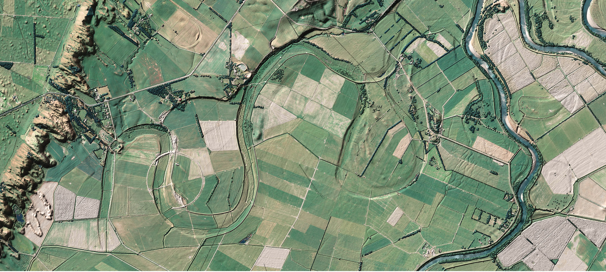
Wellington 1m DEM Hillshade Model
This map represents the base elevation derived from LiDAR points. Tree tops, houses and other objects on the land are removed using an interpolation method, revealing an idea of land elevation.
Source: https://data.linz.govt.nz/layer/53621-wellington-lidar-1m-dem-2013/
WMTS: https://xycarto.github.io/elevation.viewer.test/WMTS/DEM-WMTSCapabilities.xml
XYZ: https://xycarto-base-maps.s3-ap-southeast-2.amazonaws.com/wellyDEM-lidar/tile-cache/2020101712/wellyDEM-lidar/{z}/{x}/{y}.png
Wellington 1m DSM Hillshade Model
This map represents the elevation of all things on the surface derived from LiDAR points. In this map, one can make out where tree tops, house and other surface objects might be.
Source: https://data.linz.govt.nz/layer/53592-wellington-lidar-1m-dsm-2013/
WMTS: https://xycarto.github.io/elevation.viewer.test/WMTS/DSM-WMTSCapabilities.xml
XYZ: https://xycarto-base-maps.s3-ap-southeast-2.amazonaws.com/wellyDSM-lidar/tile-cache/2020101712/wellyDSM-lidar/{z}/{x}/{y}.png
Wellington 1m Digital Elevation SLOPE Model
Calculated slope from DEM in degrees. Light to dark: 0 -> 90 degrees. Method for calculation "gdaldem slope"
Source: Not Yet Available for Download
WMTS: https://xycarto.github.io/elevation.viewer.test/WMTS/SLOPE-WMTSCapabilities.xml
XYZ: https://xycarto-base-maps.s3-ap-southeast-2.amazonaws.com/wellySLOPE-lidar/tile-cache/2020101712/wellySLOPE-lidar/{z}/{x}/{y}.png
Wellington 1m Digital Elevation Lowlands Model
Elevation gradient. Red to Yellow: 0 -> 10m.
Source: Not Yet Available for Download